Since Apple launched its own mapping software in 2012 and faced off against Gooogle maps, it has been ridiculed from the beginning to gradually appearing affirmative voices, and Google has also accelerated the launch of an improved version of the map program. The two can be said to be in a healthy competition. Google's software response and loading speed gradually catch up with Apple, and Apple's map richness and accuracy are gradually approaching Google. At present, the most inadequate problem is that Google has not launched the iPad version of the map software until the first half of 2013!
Those who travel frequently to Japan and have an iPad mini in their hands are recommended to try "Yahoo! 地図" launched by Yahoo! JAPAN. Since the largest shareholder of Yahoo Japan is Softbank, it can naturally integrate many local resources in Japan. , This map software exclusively launched in Japan’s APP Store provides a lot of detailed maps and local information in Japan. It is also limited to the Japanese region. Of course, under the advantage of the landlord country, Yudiao Island is also included, and each expresses it!
If you want to take into account both detailed map information and large-screen browsing, and people who are accustomed to using maps to inquire about local life information, this "Yahoo! Lands" is highly recommended, but it is also necessary to have an Internet connection.It should be noted that this is a map software that is only available in the App Store in Japan. Users must first apply for an account in Japan; secondly, in comparison, the map data loading speed of this software is not fast enough, but it is acceptable.
The Yahoo! JAPAN map provides a variety of layer options. In addition to the necessary satellite aerial photos, there are also thematic maps such as railways, waters, and topography, as well as underground street data, and even white and black tones for the adequacy of light sources map.
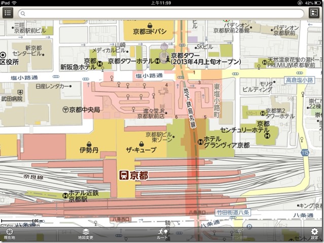
The most common map layer provides a lot of local data, and the screen is large enough to take into account the advantages of Apple and Google. The loading speed still needs to be enhanced.
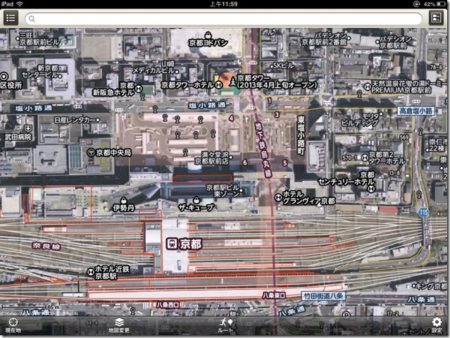
The resolution of the aerial map is quite clear. Compared with Apple's still miserable and blurry aerial map, it can be said to be a win.
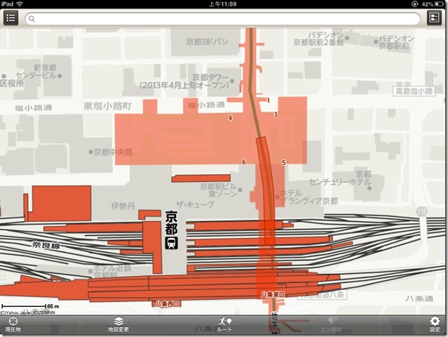
Japan, which has developed transportation facilities, must of course provide information on transportation facilities. Of course, this is also Google's strength, but Google has not yet released the iPad version of the software.
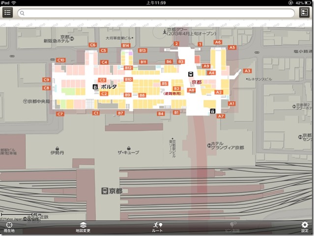
If there is an underground street in the browsing location, you can click "underground street" to see the underground street map information; if not, the option will be highlighted and cannot be clicked.
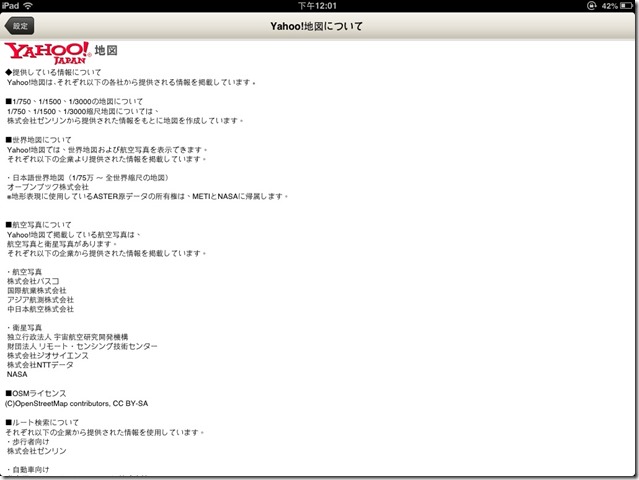
Software production information explains the partners of cooperation and the source of data.
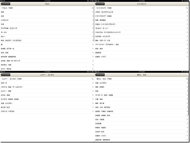
The most powerful software is information query, which is divided into four categories: "dining", "shopping", "play" and "life", providing rich and detailed sub-categories.
The sub-items of the four types of information query are classified, and there are sub-items under the sub-items, and the classification is quite detailed.Of course, you can also directly click Search All without further setting sub-items.
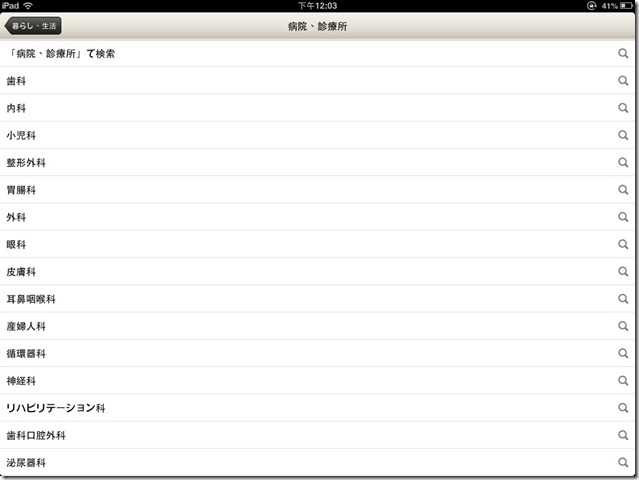
Taking the sub-item "Hospitals and Clinics" for further classification of various departments, it can be said that the classification is extreme.
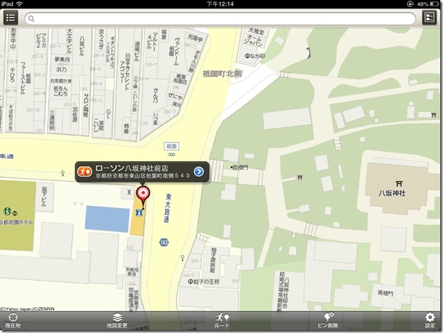
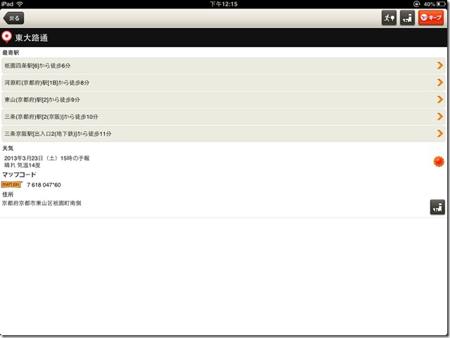
After clicking on the map often, you can place the fixed-point icon on the map, and after further clicking, you can search for other related data for the location.
Provides the address and traffic information of the location location, as well as the traffic data search of the nearest station.
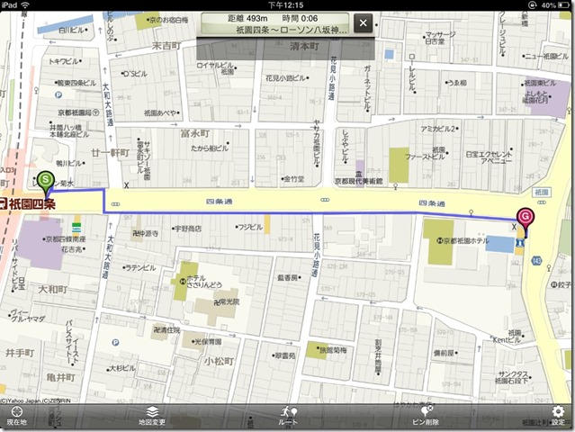
Quickly indicate the transportation mode and distance from the designated place to the nearest station, and provide a reference for the most common walking time in Japan.
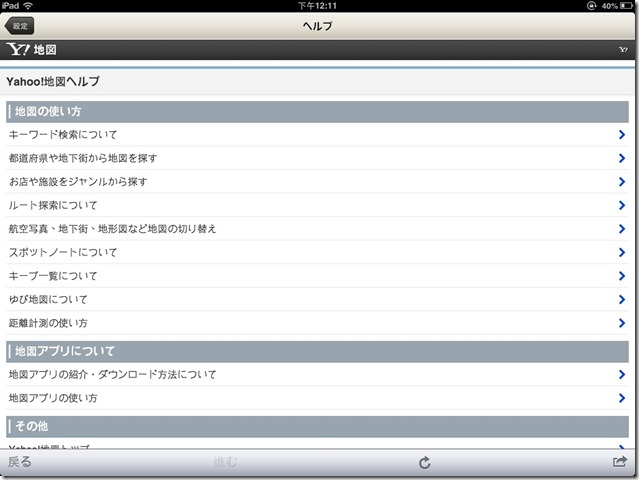
Provide detailed function and operation instructions for further reference for more advanced search and operation.
Product introduction official website
Official product introduction:
爆速で地図をUpdate しているから、地図がいつでも Latest・Correct!
Underground shopping malls, surrounding facilities, and walking trails to explore もついて全て無料.
The most suitable display for iPad is に対応.大きな屏で地図を將記できるようになりました.
★Introduction of the main function
■Landmarks/Surroundings
The upper part of the screenから开ける検索機能で周辺検索がすぐに行えます。居所や施設名で探す地図検索はもちろん、「ラーメン」「コンビニ」Na ど探したいキーワードで近くのお店ゾ設见設ゾ設設き店ゾ觾觀のお店ゾ設設つ設ゾ設設き設
■ ルート exploration function
The upper part of the screenから开ける検索機能でルート検索がすぐに行えます。ルートExplore function では, walking, car (with material road/other than それ), electric car
■ARRUTO case function
Walk, auto car, explore したルートではARルート案内能がutilize できます.
※"AR" とは, Xian実世界の影にデジタル资讯を重ね合わせて、より還な情報を貨する技术です。
※IPhone3GS およびiPadではご use いただけません.
■Store details
周辺検索で探したお店や施製の写真やクチコミ、クーポンなどの信息も說できます。また探したお店はキープ機能でSaveして后ですぐにcallび出すことや、メールやTwitterなどで友だちにににで友だちににきで友だちに。
■Location Information
地図上を长押しすることで、その地方の建物名やRoad name, residence, 天気などの信息を表示します。
■ Other
・Japanese World Map
・Aviation/Satellite photo, underground shopping mall, topographic map, railway line map, colorful map, kind provided
・OpenStreetMap
・Retrieving performance
・キープ function
This app, Yahoo! JAPAN Terms of Use (http://docs.yahoo.co.jp/docs/info/terms/) をご Confirmation No, ご用ください.
このアプリは, terminal end of telephone function へのアクセスを通じて, communication status を含むご use environment information をobtain します. Yahoo! JAPANは、Communication business person に対しCommunication environment improvement ためのreference data として当本信息を提供する傳事があります。
Na お, ko の appli wo pass ji te individual ya Duanmo ga specific Connecticut DomNode- ru information (user ya call phase chiral の telephone designation, Silicia ア Hikaru designation), call ka-do u ka の INFORMATION wo Yahoo! JAPAN ga collected suru ko と wa thou ri ma se san.


